Fort Lauderdale Maps and Orientation
(Fort Lauderdale, Florida - FL, USA)
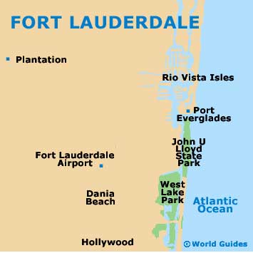
Now something of a stylish city with a noticeable air of sophistication, Fort Lauderdale still remains a leading beach destination. Located on the far southeastern coast of Florida and considered to be a part of the expansive South Florida Metropolitan Area, the city serves as the administrative center of Broward County.
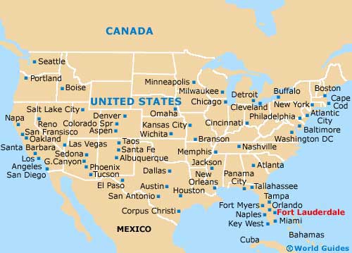
Those with a rental car may like to make a note that Fort Lauderdale is just over a half hour's drive to the north of
Miami and is also close to the Everglades Wildlife Management Area, which lies roughly 45 miles / 72 km to the west.
Interstate I-95 bounds the western side of the city and runs parallel to the Florida Turnpike / Ronald Reagan Turnpike (SR-91), roughly 5 miles / 8 km further west. The eastern side of the city edges the Atlantic Ocean, being where Fort Lauderdale's legendary spring-break beaches and coastal promenade live, along with the John U. Lloyd Beach State Park.
Maps and Orientation of the City
If you are in need of maps, then you may like to check out Fort Lauderdale's Visitors Bureau on East Broward Boulevard, which has relocated from its previous office on Eller Drive and now stands next to Stranahan Park, close to both the Broward County Library and the Florida Atlantic University.
Alternatively, look out for gift shops or bookstores selling maps around the city center, such as the large Barnes and Noble outlet at 2051 North Federal Highway.
- Boca Raton - 22 miles / 35 km (35 minutes, north)
- Coconut Creek - 15 miles / 24 km (25 minutes, north)
- Cooper City - 14 miles / 23 km (25 minutes, southwest)
- Coral Springs - 21 miles / 34 km (35 minutes, northwest)
- Dania Beach - 5 miles / 8 km (ten minutes, south)
- Davie - 11 miles / 18 km (20 minutes, southwest)
- Hollywood - 9 miles / 14 km (15 minutes, south)
- Key West - 190 miles / 306 km (four hours and 30 minutes, southwest)
- Lauderhill - 6 miles / 10 km (12 minutes, west)
- Margate - 15 miles / 24 km (25 minutes, northwest)
- Miami - 28 miles / 45 km (40 minutes, south)
- Naples - 110 miles / 177 km (two hour and 15 minutes, west)
- North Andrews Gardens - 5 miles / 8 km (ten minutes, north)
- North Lauderdale - 12 miles / 19 km (20 minutes, northwest)
- Oakland Park - 4 miles / 6 km (ten minutes, north)
- Pembroke Pines - 20 miles / 32 km (35 minutes, southwest)
- Plantation - 6 miles / 10 km (12 minutes, west)
- Pompano Beach - 11 miles / 18 km (20 minutes, north)
- Sunrise - 12 miles / 19 km (20 minutes, west)
- Wilton Manors - 4 miles / 6 km (ten minutes, north)
Map of the United States
Map of Florida

Map of Fort Lauderdale